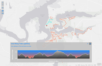
The Elevation Profile app displays the elevation profile for a selected feature or a measured line. This template uses the Profile geoprocessing service to generate elevation values along the profile. This service is hosted in ArcGIS Online.
Options
To see the options available for this template, search your ArcGIS Enterprise portal using the app template name and open the app template item's detail page.
Requirements
To use the Profile geoprocessing service, you must have access to the Internet.
If your portal is not connected to the Internet, you need to create your own profile geoprocessing service and configure a custom Elevation Profile app template. To do that, log in to a machine that does have Internet access and download the Elevation Profile app template. The downloaded file contains the Profile Tool, sample data, and documentation. Follow the instructions in the documentation to use the Profile Tool with your data to create the profile geoprocessing service. You must have the ArcGIS Spatial Analyst extension and ArcGIS 3D Analyst extension to publish a custom profile geoprocessing service.